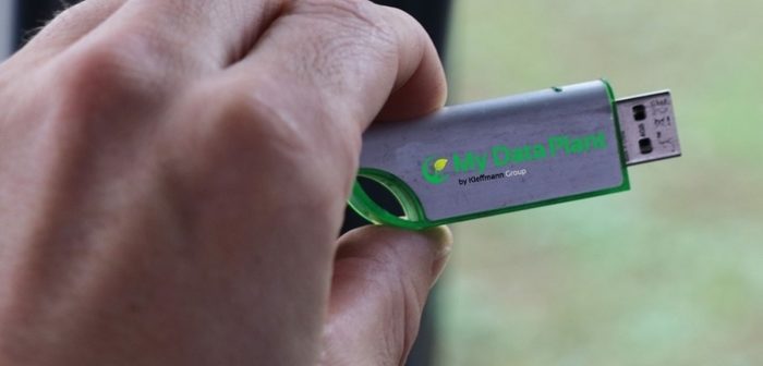
Farmers in Europe and the UK and ultimately all over the world can benefit from a completely independent decision support mapping tool called My Data Plant using Sentinel satellite imagery, developed by Kleffmann Group. Farmers using this system are able to visualise biomass variance within a field to an accuracy of 5m x 5m and are able to monitor biomass development throughout the season. This will allow monitoring of differences and changes within the growing crop from the farm office or mobile device, with biomass providing an insight into the current health of the crop. Ultimately, the tool is used to generate variable rate fertilizer maps, based on the growers’ desired average rates and tailored to field conditions and crop potential. The fertilization map information can be downloaded onto a PC, tablet or smartphone or onto an USB stick which is compatible with most precision software on the tractor. Optimal, variable rates of fertilizer can then be applied using precision applicators across the field.
“This innovation does not require a specific farm size or machinery because with the help of the intuitive web portal, it is possible to tailor make fertilizer requirements to ones’ needs from your desk. It is also important we feel to have an independent stand-alone system which is not directly linked to any input or service manufacturer. With just a few clicks, farmers can generate bespoke maps of the farm. Advisors, agronomists or land agents can do the same for a number of their clients,” says Roger Pratchett of Independent Business Resource Limited, the UK Alliance Partner for Kleffmann.
Kleffmann Group identified the practical solution for the farmer as a consequent development towards an integrated and digitalized communication with the farmer. Stephan Poppe, Head of Innovations and Development states “For the regular process of
our panel research methodology, precise information of the agricultural area is needed. The available official statistics in many countries are often incomplete or offer only
limited information about cultivated area. The satellite technology provides a solution to fill in the gaps and provides complete information with accurate generation of data. It also more importantly supports farmers in precision farming.”
Kleffmann launched the European system at the Agritechnica Fair in Hannover last month. Bukhard Kleffmann, CEO of Kleffmann Group says “We had positive feedback from farmers at the Agritechnica Fair. Numerous farmers registered for the tool there – from Germany and other European countries but also Indonesia, India and Brazil.”


